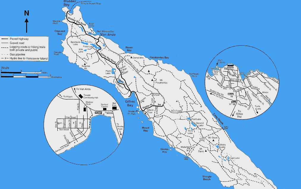
Gillies Bay is on the west coast of Texada Island, surrounding a large
sandy bay.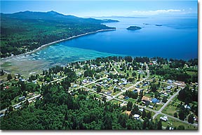
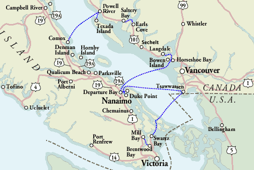
Texada Island is located in the Strait of Georgia, between Vancouver Island and the mainland coast of British Columbia, close to Powell River. Texada Island has two main communities, Gillies Bay and Van Anda, far away from the hustle and bustle of big cities.
It is an area of outstanding natural beauty, boasting spectacular coastal and mountain scenery. Texada offers visitors great hiking, cycling, beachcombing, camping, kayaking and scuba diving, as well as exceptional wildlife viewing opportunities.
For more Texada Island details check VancouverIsland.Com
The largest of the Gulf Islands, Texada is 32 miles long and six miles wide, located approximately 50 miles north of Vancouver in the Strait of Georgia.
The northern tip of Texada Island is located near Powell River, the largest community on the Sunshine Coast. BC Ferries operates a ferry service on a daily schedule from Powell River to Blubber Bay on Texada Island. Powell River is accessed by ferry from Comox on Vancouver Island or from Vancouver in the south (5 hours, 88 miles/141 km) by catching a ferry from Horseshoe Bay to Langdale, driving from Langdale to Earls Cove on Highway 101, and catching another ferry from Earls Cove to Saltery Bay. Powell River is 18 miles (29 km) northwest of Saltery Bay on Highway 101.
You can fly to GilliesBay on charter flights from Qualicum on Vancouver Island.